How 3D scans are making work easier for designers and builders
Written by
23 January 2024
•
5 min read
In a recent interview with Simon Cookes, CEO of LARKI, ArchiPro delves into the transformative impact of 3D scans on the Australian design and construction industry.
LARKI, a provider of 3D laser scanning and BIM modeling services with a unique web platform, aims to make high-quality 3D surveys accessible to projects of all sizes, from small home renovations to large-scale institutional developments.
3D scanning's precision and time efficiency
Cookes highlights a fundamental issue with traditional 2D surveys – “Proportionally speaking, they are more of a diagram than an accurate representation of our three-dimensional world. A 2D drawing, by nature, is a low-detail, simplified representation which cannot capture all the intricacies of a real-world structure," says Cookes.
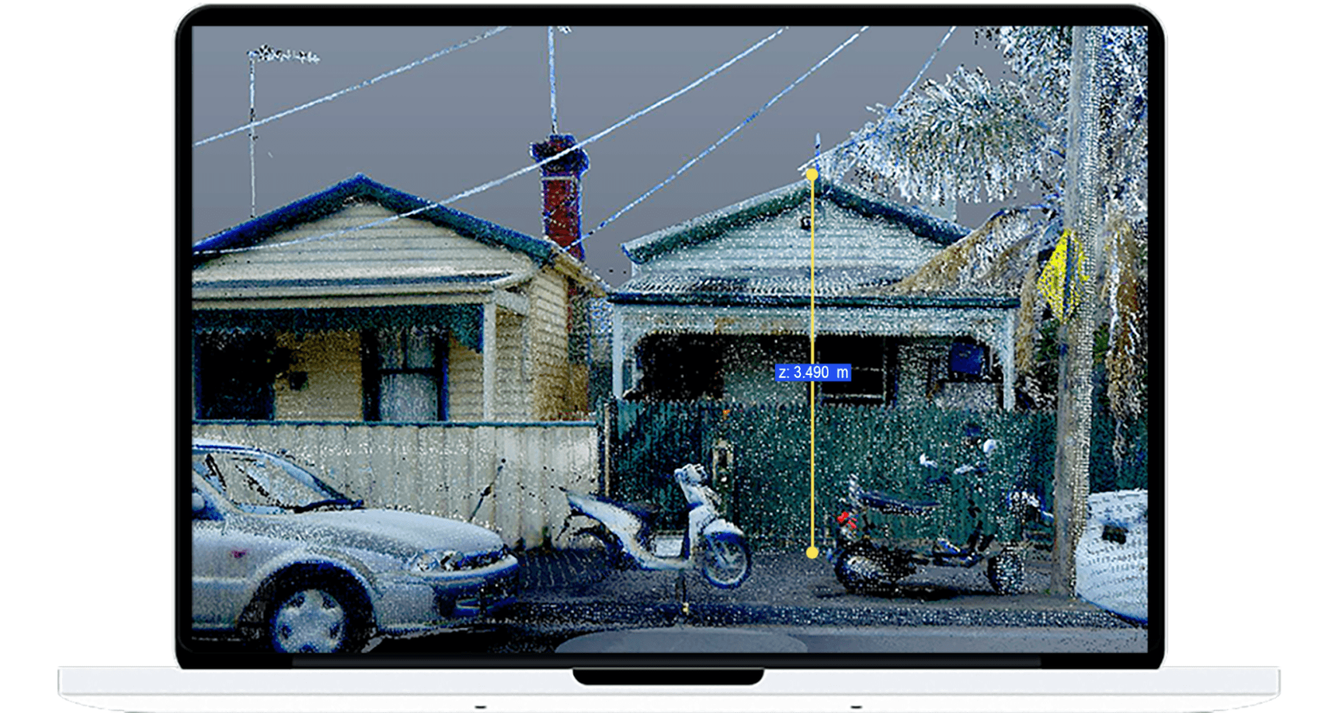
Cookes emphasises the disparity in resolution between a 2D feature survey, typically comprising 100 site data points for a small project and a 3D scan of the same area with a whopping 30 million points – a 300,000x increase in features than can be measured.
Based on his 25 years in the architecture industry, Cookes notes that the traditional approach often not only adds to the project's cost in the end but also introduces the potential for human error and even litigation.
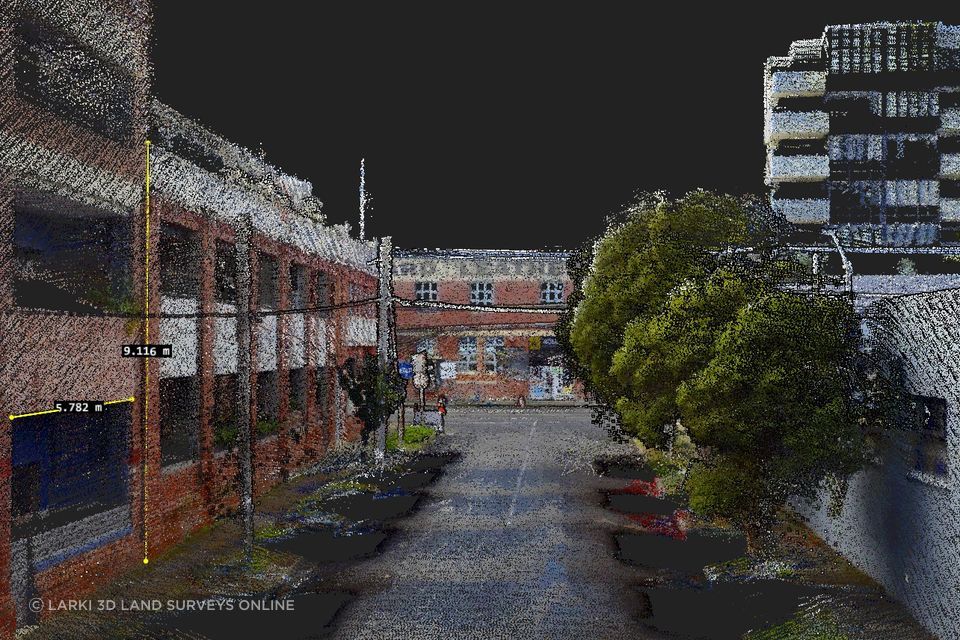
"With 3D scans, the need for repeated in person site visits is drastically reduced or eliminated. LARKI's platform allows stakeholders, including architects, engineers, builders, planners, and clients, to access detailed 3D online. This makes previously hard-to-reach features like light fittings, decorative trusses, window frames, powerlines and tree tops easy to measure online," says Cookes.
The power of 3D scans lies in their ability to offer enhanced visualisation, allowing users to conduct virtual walkthroughs and understand the space comprehensively. Cookes stresses that 3D scans streamline communication and reduce lost days, weeks, or months of back-and-forth between stakeholders, in particular with planning permit authorities.
Preserving and recreating heritage listed building with 3D scans
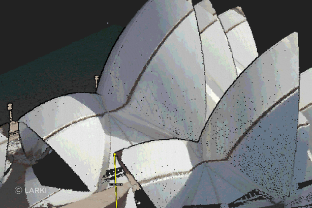
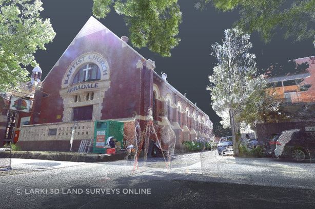
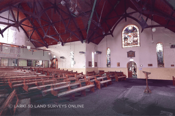
Cookes shares an example of the Notre Dame Cathedral in Paris, which was tragically ravaged by fire. Fortunately, the structure had been previously 3D scanned, enabling the recreation of the building with meticulous accuracy. This illustrates 3D scans' critical role in preserving heritage and complex structures. LARKI has undertaken similar projects, scanning heritage facades and enabling accurate reconstruction using the original materials.
Increased safety and accessibility with 3D scanning
Cookes lists other advantages beyond accuracy, with 3D scans contributing to safety in construction. "Traditional surveys may involve risky tasks such as climbing scaffolds or accessing difficult-to-reach steep rocky or slippery areas. Our high tripods and drones are equipped with scanning technology offering a safer alternative, capturing data from various angles without putting humans at risk," he says.
- Cookes provides valuable insights into different 3D scanning technologies, emphasising the precision of laser scanning or LiDAR versus photo-generated 3D and architectural modeling packages.
"LARKI offers various approaches, such as 3D laser scanning to help with accurate measurements, photogrammetry for marketing renderings and BIM (Building Information Modelling) for documentation. LARKI can provide 3D files for download as well as a user-friendly web viewer which makes detailed and accurate 3D scans accessible regardless of the user's skill or the project's size and budget. Allowing users to make informed decisions based on their specific needs from their desktop, laptop, mobile or tablet devices," says Cookes.
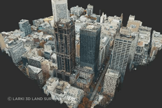
The extensive 3D laser-scanned point cloud database maintained by LARKI further sets it apart. With a wealth of 3D data for major cities like Melbourne, Sydney and Brisbane, clients can access pre-existing scans for streetscapes and aerial views, to show a broader context. These site context point cloud files can be downloaded in minutes, fast-tracking projects which saves crucial time in development feasibility, concept design and plan permit approvals.
Endless applications
Cookes illustrates how 3D scans cater to various applications. He cites an example of an engineering firm using scans to assess the suitability of road clearances for delivering large equipment and for buildability assessments. 3D scans help designers and building work with complex built and natural forms. LARKI’s 3D files data can also be used in tree cover, overlooking, overshading and energy rating assessments.
LARKI can scan at different stages of construction to show: services in the ground; slab flatness; pipes, structure and conduits in walls and ceilings; and as an as-built digital twin for facility managers This showcases the versatility of LARKI's 3D scans, data and platform in addressing challenges across different the full property development, design, permitting and construction and maintenance lifecycle.
"Our platform makes it easy for people to self-service online; purchase, share, upload and download the information – this user-friendliness is unique to LARKI," says Cookes.
"We've got a huge amount of data already in our database, which means that for things like a streetscape elevation or broader context flythrough, like if the customer is doing a development feasibility or planning permit application, you can go online and download, view or measure straight away,"
"So, they don't have to wait two weeks and spend thousands of dollars on a surveyor and architect’s measure-ups to build up that information before they can start working," Cookes adds.
LARKI underscores the transformative impact of 3D scans on the design and construction industry. From enhanced precision and reduced human error to improved safety and efficiency, 3D scans have become indispensable tools for developers, architects, planners, engineers and builders. LARKI's commitment to making this technology accessible and user-friendly further solidifies its position as a leader in the 3D scanning ecosystem.
To learn more or for help with your next project, reach out to LARKI on ArchiPro.
