
About
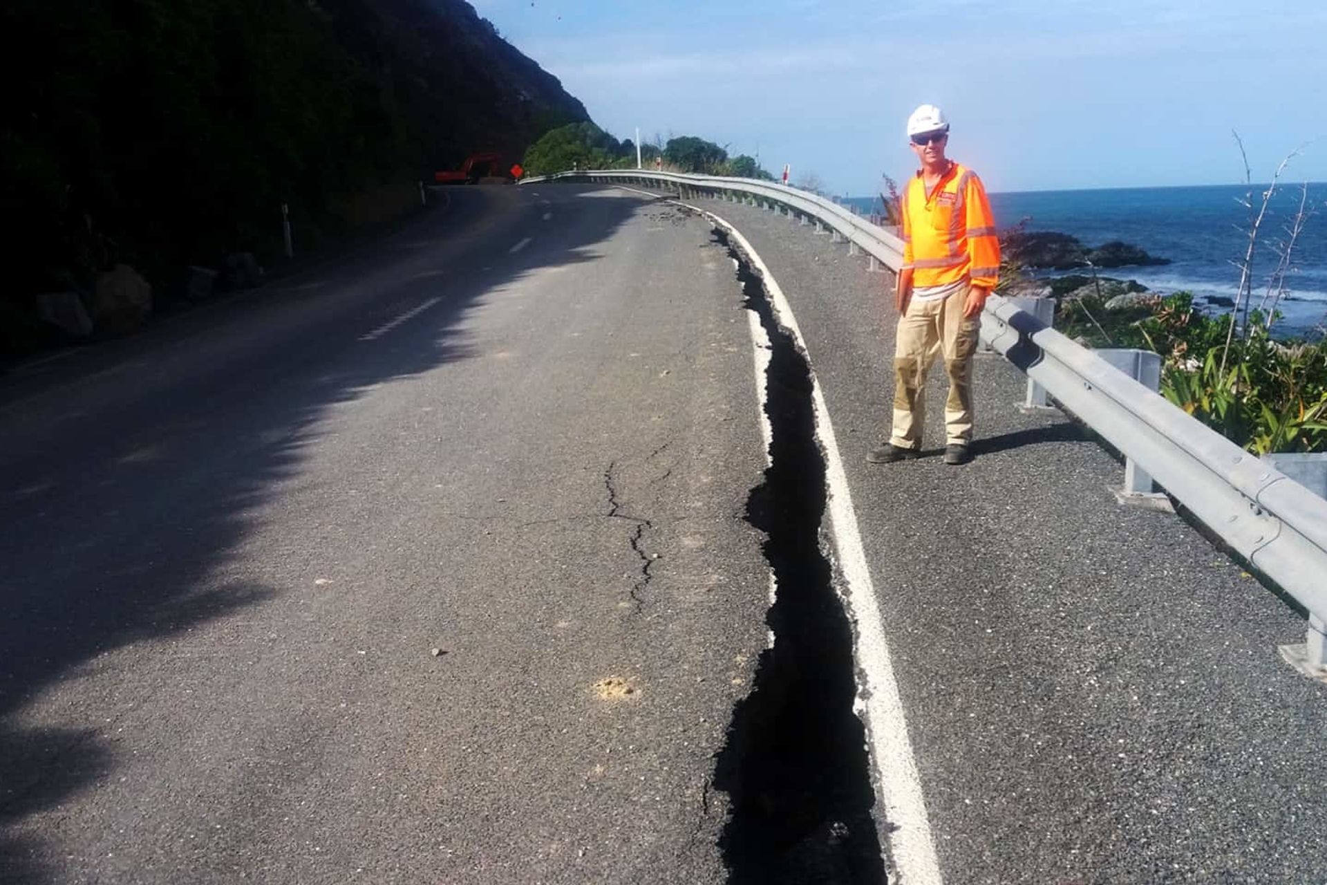
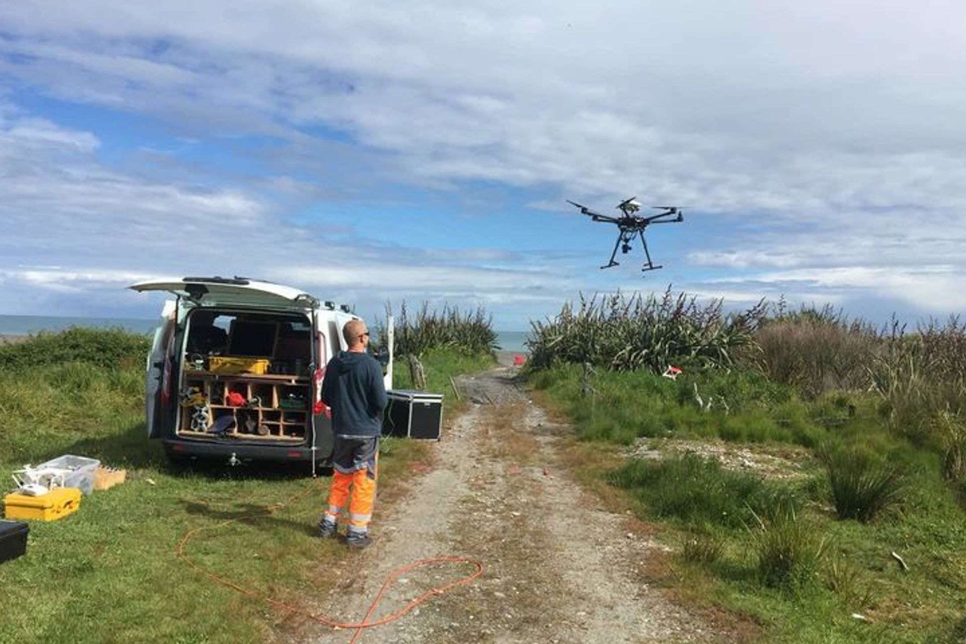
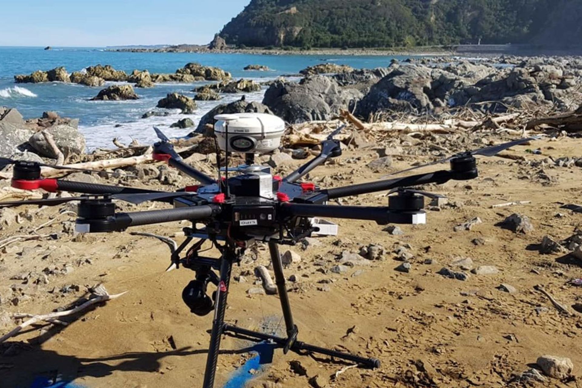
Kaikoura Coast UAV Survey.
ArchiPro Project Summary - Innovative UAV Survey Methodology for Kaikoura Coastline Reconstruction Post-Earthquake
- Title:
- Kaikoura Coastline UAV Survey
- Civil Engineer:
- Eliot Sinclair
- Category:
- Community/
- Transportation
Project Gallery


Inspired by this project?Visit Eliot Sinclair

Eliot Sinclair. Delivering Smarter Project Outcomes. Eliot Sinclair is a team of land and site development consultants. We’ve earned a reputation as a trusted partner capable of delivering numerous residential, industrial and commercial land developments, and construction projects of any size or complexity.
Tap into the power of many talented surveyors, planners and engineers working together. Whether you need our services in isolation or as an efficient integrated partnership we have the ability to scale our integrated approach to match our client’s needs. With a long-standing connection to Canterbury and a South Island-wide client base, we bring decades of knowledge and experience to your project.
Year Joined
2020
Established presence on ArchiPro.
Projects Listed
11
A portfolio of work to explore.
Eliot Sinclair.
Profile
Projects
Contact
Project Portfolio


Other People also viewed


Why ArchiPro?
No more endless searching -
Everything you need, all in one place.Real projects, real experts -
Work with vetted architects, designers, and suppliers.Designed for New Zealand -
Projects, products, and professionals that meet local standards.From inspiration to reality -
Find your style and connect with the experts behind it.Start your Project
Start your project with a free account to unlock features designed to help you simplify your building project.
Learn MoreBecome a Pro
Showcase your business on ArchiPro and join industry leading brands showcasing their products and expertise.
Learn More